
Germany · taz · · 2h
Study on the renaturation of rivers: dismantling weirs, planting floodplains
Deutsch (original) · Auto-translated to English
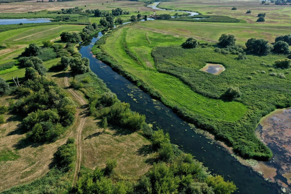
Until now, the Wehdemühlenbach near Berge in Lower Saxony flowed straight through the landscape. Since July he has been allowed to snuggle in again, make bends and form shallow water zones. This is ensured by the “Haseauenverein”, which has set itself the goal of renaturating the Hase river and adjacent waters. The “revitalization of the Wehdemühlenbach” is one of the measures in the six-year project as part of the Federal Government’s Natural Climate Protection (ANK) action program. It supports projects like the one in northwestern Lower Saxony with a total of four billion euros.
Once a week, the association invites residents and farmers to a construction meeting to ask questions about measures at Wehdemühlenbach and to make suggestions. Children from the neighboring primary school help at the stream construction site, “so that they can get to know the plants and animals there and actively help them themselves,” says Björg Dewert, managing director of the Haseauenverein. It is important to take the local people with you, because only with them can the renaturation succeed.
The measures are intended to retain water in the landscape in times of heat and drought, create natural sinks for greenhouse gases and create habitats for animals and plants. But which measures make sense, which serve which purpose particularly effectively - and which perhaps less so? The Nature Conservation Association of Germany (Nabu) examined these questions in a study using the Lower Havel Lowlands as an example. In the large-scale nature conservation project, which extends across the federal states of Brandenburg and Saxony-Anhalt, floodplain forests and floodplains are being created on a large scale, tributaries of the Havel are being reconnected to the river and banks are being unsealed.
The Nabu Institute for River and Floodplain Ecology (Nabu-IFA) evaluated 12 measures with regard to the three goals of the ANK: saving greenhouse gases, regulating the regional water balance and improving biological diversity. The IFA examined the ability of riparian forests in particular to store greenhouse gases. Carbon-containing sediments are deposited in them, plants decompose and their carbon migrates into the soil.
The institute also looked at how long the water remains in the landscape, whether the river can release water into the groundwater and whether the surrounding floodplain soils can absorb and thus regulate flood water. Last but not least, not individual species but rather habitats were examined. The more diverse they are, the more species of plants and animals can live there.
The measures considered include the dismantling of weirs, i.e. barrages, the creation of river islands, the introduction of dead wood, the unsealing of the banks, the construction of hiking aids (“fish ladders”) and the creation of riparian forests. This shows: “In all three assessment areas, types of measures achieved the best results if they support the development of morphology and hydraulic conditions towards more natural conditions,” says the study. The best thing to do is to restore the river's natural course with meanders, branches and a diverse riverbed and to ensure that the water can flow faster in some places and slower in others.
Rivers can become effective carbon stores and water regulators if they are converted on a large scale - which means interventions for the surrounding landscape. This is also shown by the example of the only type of measure to which Nabu certifies low effectiveness: the construction of lifts that help migratory fish species, for example. They help them effectively - but only them. This is not how new habitats are created.
However, local, small-scale measures also make sense. In this way, several planned river islands can have a positive influence on the flow of the water and the bank and create living spaces. The dismantling of weirs also has a positive effect in terms of the three goals, but only in the case of a largely natural river. Otherwise the water would flow out of the landscape even faster.
The studies on the Lower Havel, a river in the North German Plain, cannot easily be transferred to rivers in the mountains, for example, emphasizes Nabu. Local site conditions would have to be taken into account and evaluation criteria would have to be adapted accordingly. The “assessments carried out therefore serve as a guide to systematically assess comparable types of measures and estimate potential impacts,” according to the study.
“We all have to learn from each other,” says Björg Dewert from the Haseauenverein. “It’s important to look at other examples so that everyone doesn’t muddle around on their own.”
Read the full story at the source
Source: taz